Astoria--This charming little town is full of historic Victorian homes overlooking the coast and mouth of the Columbia River. Just north of the town is the 4.1 mile long Astoria Bridge which goes over the Columbia River to Washington. Fishing for salmon, sturgeon, and crab are very popular here as well as exploring the shops and galleries along the Riverwalk area.


Just south of Astoria is Fort Clatsop State Park. Fort Clatsop was the winter encampment for the Corps of discovery from December 1805 to March 1806, led by Lewis and Clark. Because of all the pacific northwest rain, the original camp quickly decayed after they left. The National Park Service now maintains a replica fort within the Lewis and Clark National Historical Park that is believed to sit on or near the site of the original fort. It was interesting walking among the small buildings and seeing the small quarters in which the explorers lived. Average height of men back then was about 5'4", although both Lewis and Clark were both over 6' tall. The quarters were definately built for the smaller in stature. The center now features ranger-led programs, re-enactors in the fort and trailheads for the Fort To Sea Trail and Netul River Trail as well as restrooms and a picnic area. Admission is only about $3 @ and is good for a week. It was an interesting way to learn a little history.


Not far from Hugs Point is the town of Seaside. This is a popular tourist town with it's 1.8-mile long ocean front Promenade, carousel, arcades, miniature golf, bumper cars and boats, tilt-a-twirl, paddle boats, canoes, eateries, .... and even---surfing.

Yes, Angie talked us into letting her take a surfing lesson here one time. The surf shop provided the wet suit and the instructor went out with her for a couple of hours while we watched from the shore. She even made it up to a standing position on the board a couple of times and didn't even get eatten by any great white sharks!


the very touristy town of Seaside


Just another view at Hugs Point. There was no fee for this park.

The "road" carved into the rocks for stagecoaches and cars back in the early 1900's.


Tillamook Cheese!---the best cheddar cheese in the world. The Tillamook County Creamery Association is a 101 year old farmer-owned dairy cooperative. In 1979, an expanded Visitor's Center was opened to the public, offering an observation area, an educational slide show, a museum, a deli and fudge counter, and an ice cream counter. We use to make a point of bringing Tillimook cheddar cheese back to St. Louis with us everytime we vacationed in Oregon.

The first time we went there, the cheese was made manually. It was really interesting watching from the viewing platform and seeing all the stages that go into making cheese. As their popularity gained, it became necessary for them to go with automation. In 1990, they made a new cheesemaking room and transitioned to a new, fully automated cheddaring system, known as the “Cheddarmaster.”

A mixture of dairy cow breeds, starting with Holstein-Friesians and complemented by Jerseys, Brown Swiss and Guernseys, gives the blend of butterfat and protein components that is perfect for making the best cheeses in the world. The fresh, cold milk passes through the heat-exchanging pasteurizer. The milk is then sent on to the cooking vats. Starter culture is added to produce lactic acid. For cheddar cheese, a natural coloring from the Annatto seed is added. Then a material is added to coagulate the milk into curds. After about 30 minutes, the vat of milk is ready. A soft curd, made up of casein, a naturally occurring milk protein, forms. Large stainless-steel knives are used to cut the soft curd mass into ¼-inch pieces. The temperature in the cooking vat is then raised to about 100° F to aid in firming the curd and releasing liquid from the curd particles. This liquid, called “whey,” contains milk sugar, minerals and water-soluble milk proteins. When the curd has reached a satisfactory texture, the curds and whey are pumped to the Cheddarmaster unit where the whey is drained. The curd is matted on a six-foot-wide belt inside the Cheddarmaster. When the proper acidity is reached in the curd, the cheddar mat is forced through the curd mill, which chops the large slabs into small, three-inch-long bits. These loose curd chunks are then passed through a salting chamber inside of which each curd is dusted with a thin layer of crystalline salt. After 30 minutes in the pressing towers, 40-pound cheese blocks are cut from the base of the towers and placed in laminated plastic bags where they are then cured for a minimum of 60 days.


They have accumulated quite a collection of old airplanes with over 30 War Birds, including a P-38 Lightning, F4U-Corsair, P51-Mustang, PBY Catalina and SBD Dauntless dive bomber, as well as other aviation artifacts. This car and trailer gives a little perspective of just how big this hanger is.

From Tillamook the coastal highway goes inland for quite aways. That's why we usually went south from Lincoln City where highway 101 stayed within view of the ocean most of the way. There are a couple of interesting places inland between Tillamook and Lincoln City, though.


Lincoln City was voted the "Kite Capital of the World" because of it's steady winds unique to it's location on the 45th parallel. Kite companies use to bring huge kites to the beach for display and we would watch them fly for hours.

Here Angie is about to try her luck with the typical basic kite that every kid had at one time or another.

Although the beaches and scenary are beautiful, it certainly isn't the sunbathing, water enjoying kind of place that Hawaii or Florida is. Even in summer we usually had coats or sweatshirts on.

Just east of Lincoln City is Devil's Lake. They even had a bumper boat place on one side of the lake. The kids had a blast doing that a couple of times. I'm not sure if that is still there.


Devils Lake is 1/3 mile wide, 3 miles long, and only reaches a depth of about 22 feet. There are nine species of freshwater fish there. Ken and the kids tried their luck fishing there a few times, but never seemed to have any luck. Flowing from Devils Lake is the "D" River, which holds the title of the "World's Shortest River". From its source at Devils Lake, the river reaches its destination of the Pacific in a mere 120 feet.

Entering into Lincoln City, you can try your luck at Chinook Winds Casino, Oregon's premier Casino. Owned and operated by the Confederated Tribes of Siletz Indians of Oregon, the spirit of the Tribe is captured in the decor of the facility. It opened in 1995. The casino is a Las Vegas-style facility with more than 1,100 slot machines, along with keno, bingo, craps, roulette, blackjack and poker. There are also convention venues and 3 dining areas within the complex.


Built in 1914 just south of Lincoln City and only 1.5 miles from the coast, this bridge was considered the oldest remaining covered bridge in Oregon until excessive rot and insect damage had weakened the bridge to a dangerous level and it had to be taken down in 1997. I always enjoyed going to it and wandering around the creek bed.
Jan. 2012--- I was just told that it was moved to a home near Bear Creek.


Mo's! Mohava Marie Niemi opened her first Mo's in 1940. Now there are 6 locations. Demand for Mo’s Clam Chowder resulted in The Chowder Factory which produces about 500,000 pounds of clam chowder a year, some packaged and shipped to grocery stores and the rest delivered fresh to all the Mo’s Restaurants. Although the restaurant does have a reputation for it's chowder and


Depoe Bay is a quaint little ocean town with a small marina and lots of tourist shops and restaurants. We've taken a few whale watching tours our of the marina there, but haven't been too impressed. Our whale viewing from the Worldmark resort has been much better and we didn't have to put up with crazy boat captains who seem more interested in trying to make passengers sick then looking for whales. But the town of Depoe Bay is a neat little town to wander around in. A huge sea wall runs the length of the downtown area allowing visitors to shop or dine always within view of the ocean. One of the really nice restaurants there is Tidal Raves with this fantastic view of the ocean from it's diningroom. We also really enjoy the Sea Hag and the Chowder Bowl across 101 from the ocean.

One of our favorite places to grab a bite to eat in Depoe Bay is the Chowder Bowl.


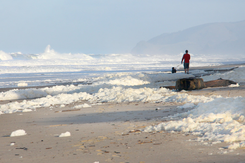
A few miles south of Depoe Bay 101 descends back down to the ocean. There are lots of places to pull off and get to the beach. Many times we have enjoyed playing on the Oregon beaches and even dipping our feet in the COLD ocean.


Here is the tide pool area. At low tide it's fun to walk along the pathways and look in the tide pools. Along with lots of little fish, we often saw different colored star fish, anemones, and crabs in the tide pools.

This is the rocky "beach" area which has always intriqued us. We would sit for hours tossing the ocean tumbled rocks and watching them bounce in different directions on their way to the ocean. It was also interesting listening to the tide recede through the rocks with a clanking sound. Quite often there are even seals to watch off shore near the outcroppings of rocks.

Just south of Yaquina Head lighthouse is Newport. Newport is located on the central Oregon coast and has been a favorite tourist destination since the 1860s. Along with the rather large marina, there is a great beach, another lighthouse, a 29 Acre Oregon Coast Aquarium, Hatfield Marine Science Center, and Bay Boulevard tourist area, where restaurants, galleries, shops, and attractions such as Ripley's Believe it or Not,

the Waxworks Museum

and the Undersea Gardens are side by side with working canneries and fish-packing plants. Many of which are painted with fabulous murals on their outside walls.

I also enjoy wandering along the walkways of the marina looking at all the boats.

As well as fishing trips, crabbing trips are available, and many of the charter boats have facilities for cooking the crabs back at the docks, for an additional fee. Or you can rent crab traps from one of the bait shops and crab along the piers.

This bridge across the Yaquina River allows traffic on US Highway 101 to cross. To me it's a great photo-op.

Even from the other side of the bridge.

USA Today and Coastal Living Online have ranked the Oregon Coast Aquarium among the top ten aquariums in the United States. It's big claim to fame is that it housed Keiko, the orca from the movie Free Willy, from January 1996 until 9 September 1998. Admission is about $15/person, but is an interesting place to go.

Just down the street from the Oregon Coast Aquarium is the Hatfield Marine Science Center. At $0 admission, this is where we usually went instead of the Oregon Coast Aquarium. Located on Yaquina Bay in Newport, Oregon, the Visitor Center is the public wing of Oregon State University's Mark O. Hatfield Marine Science Center and is managed by Oregon Sea Grant. Exhibits feature live marine animals, interactive puzzles and games that demonstrate marine science concepts and other aspects of our amazing ocean planet. They even offer estuary guided tours.

Historic Yaquina Bay Lighthouse in Newport was built in 1871 and decommissioned in 1874. It was officially restored as a privately maintained aid to navigation on December 7, 1996. It is believed to be the oldest structure in Newport. It is also the only existing Oregon lighthouse with the living quarters attached and the only historic wooden Oregon lighthouse still standing. The Yaquina Bay Lighthouse is listed in the National Register of Historic Places. Entrance is free with donations excepted. Being a period furnished building, it is well a donation to see it.

I was reminded that I didn't have the Rogue Brewery on here---so here it is!

Now whenever I go to the Oregon coast, I have to bring back beer, cheese and t-shirts from the brewery. The food is very good, too!


Shore Acres State Park is located on the Cape Arago Highway, 13 miles southwest of Coos Bay/North Bend and U. S. Highway 101. It began as a private estate with luxurious gardens featuring trees, shrubs, and flowering plants brought from around the world aboard the sailing ships of pioneer lumberman and shipbuilder Louis J. Simpson. In 1942, Simpson's beloved Shore Acres was purchased by the state of Oregon for use as a public park. A fully enclosed observation building now occupies the site where Simpson's mansion had been, offering spectacular views of rugged seascapes, towering storm waves, and glimpses of migrating whales from December through June.

Shore Acres has been designed to take advantage of the area's mild climate. They have created a "garden for all seasons" - with showy "peaks" of different kinds of flowers every time of the year. there is an admission fee, but I think it's only about $3---well worth the cost.


We were fortunate enough to have a beautiful sunset that night and I spent quite some time on the beach.

The monoliths on Bandon beach are quite impressive!

I've found that along the coast the sun often just disappears behind a bank of clouds and sunset isn't that spectacular. When you do happen upon an outstanding sunset, consider yourself fortunate!

OK, enough of the sunsets! You get the idea.

One more picture of one of the Bandon monoliths before continuing south.

A couple things I found really fascinating along the southern coast are the fields of Easter Lilies and the cranberry bogs. Unfortunately I didn't get pictures of them.

What a great post. I love Oregon so much! But you forgot to tell everyone how amazing Rouge is! :) This is making me really excited for our trip this summer.
ReplyDelete